-
by
Cecilia Levine
Your Community
A wintry mix will bring hazardous travel conditions across the region beginning late Wednesday night into Thursday morning, Feb. 6, prompting several school delays and closings, officials say.The following schools in North Jersey announced delayed openings or closures:BERGEN (closed):AllendaleBergen County Special ServicesBergen County ...
-
by
Joe Lombardi
National Interest
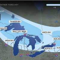
It likely won't be long for parts of the Northeast to see a new round of wintry precipitation just days after a quick-moving storm heads east.With high temperatures climbing to around the 40-degree mark on Friday, Jan. 31, precipitation later in the morning and for the rest of the day will be in the form of rain for most of the region, with a wintry mix farther north and inland. ...
-

by
Cecilia Levine
Weather
A weak winter system is expected to bring a mix of light snow and rain to parts of New Jersey and Pennsylvania beginning Friday morning, Dec. 20, and lasting into early Saturday, Dec. 21, the National Weather Service (NWS) in Mount Holly said.A weak system will move through Friday into early Saturday morning, bringing a mixed bag of wintry weather across the...Posted by US National ...
-
by
Cecilia Levine
Weather
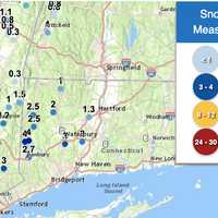
Dozens of schools across Connecticut had delayed openings due to a wintry mix that fell into Monday morning, Dec. 16.Some parts of the state saw 4 inches of snow, while others got a light dusting.According to the National Weather Service, the highest amount of snow fell in New Milford (4 inches); Cornwall saw 2.5 inches; Litchfield saw two inches, Waterbury saw 3 inches; Meriden saw 2 ...
-

by
Cecilia Levine
Weather
Temperatures are expected to surge near 60 by the end of the week, but come next, parts of New Jersey and Pennsylvania could be back in old man winter's grip, forecasters say.According to AccuWeather, a storm on Sunday, Jan. 29 will bring rain to major cities. For northwest New Jersey, northern Pennsylvania and parts of Central Pennsylvania, however, a mix of rain and snow — or perhaps ...
-

by
Cecilia Levine
Weather
Parts of New Jersey and Pennsylvania were expected to see a dusting of snow Wednesday, Dec. 6.The National Weather Service was showing wintry weather in northwest New Jersey, the Lehigh Valley, and the Poconos, with flurries already falling as of 2 p.m.We can expect to see some light snow showers and flurries throughout the day Wednesday, with the greatest chance across...Posted by US ...
-

by
Joe Lombardi
Weather
A quick-moving storm moving across the region will bring up to a foot of snow to parts of the Northeast.The time frame for the system is late Tuesday night, Nov. 15 into Wednesday morning, Nov. 16.For brand-new snowfall projections from AccuWeather.com, see the image above:1 to 3 inches (areas shown in Columbia blue), 3 to 6 inches (areas shown in darker blue), 6 to 12 inches (areas ...
-

by
Joe Lombardi
Weather
The arrival of winter, which came late Tuesday morning, Dec. 21, will be followed by several separate rounds of precipitation leading into Christmas Day, with the potential for chances for sleet and snow in areas farthest north and inland.The first chance for a wintry mix will come late Tuesday night into early Wednesday morning, Dec. 22 in the areas marked in the image above.Most of ...
-

by
Joe Lombardi
Weather
A storm system that will sweep through will bring a wintry mix leading to icy travel conditions for much of the region.A Winter Weather Advisory is now in effect from 11 p.m. Wednesday, Feb. 5 through 10 a.m. Thursday, Feb. 6 for the areas shown in purple in the first image above.Ice accumulations of around one-tenth of an inch and sleet accumulation of up to one inch are expected ...
-

by
Joe Lombardi
Weather
A return to more seasonable temperatures will be followed by a storm system that will bring a mix of snow, sleet and rain to the region.Though it's too early to predict potential accumulation totals, the time frame for the storm is Saturday, Jan. 25 through Sunday, Jan. 26.Wednesday, Jan. 22 will be sunny with a high temperature in the mid to upper 30s with wind-chill values between 20 ...
-
by
Joe Lombardi
Weather
There's now an increased likelihood for a storm expected to bring a snow and a wintry mix to the region at times this weekend.Though it's too early to predict potential accumulation totals, the time frame for the storm is overnight Friday, Jan. 24 through Sunday, Jan. 26.The rest of the workweek will be dry with milder air arriving for Thursday, Jan. 23 and Friday, Jan. 24. The high ...
-

by
Joe Lombardi
Weather
A return of blustery conditions with wind-chill values below the freezing mark will lead the way to a quick-moving storm that will bring snow and a wintry mix to the region.Here's the five-day forecast:Sunday, Jan. 5: The high temperature will only be in the mid to upper 30s on a day in which there will be a mix of clouds and sun. Wind out of the northwest at 16 to 21 miles per hour ...
-

by
Joe Lombardi
Weather
Rain has started to move across the area and has transitioned to freezing rain and sleet farther inland even in some spots where the temperature is above the freezing mark as a complex storm has arrived in the region.The wintry mix has been reported after nightfall on Sunday, Dec. 29 mainly north of Interstate 84, especially in areas with high elevations.Freezing rain, sleet and snow ...
-

by
Joe Lombardi
Weather
Click here for a new, updated story: Projected Snowfall Totals Increase For Powerful Storm System That Will Sweep Through AreaAs a powerful, quick-moving storm that will bring a mix of snow, sleet and freezing rain nears, Winter Weather Advisories have now been issued for much of the region.The advisories are in effect from 6 p.m. Monday, Dec. 16 until 6 p.m. Tuesday, Dec. 17 for the ...
-

by
Joe Lombardi
Weather
Click here for an updated story: Accumulating Snowfall Now Expected For Early Week StormGet set for a stormy stretch with two separate systems due to move through the region, with the second bringing a wintry mix and snow.The first storm system will usher in the start of the weekend. But temperatures began to rise as it arrived on Friday afternoon, Dec. 13, keeping precipitation to ...
-

by
Joe Lombardi
Weather
Click here for an updated story - Weather Whiplash: Wintry Mix Will Sweep Through After Temps Surge To Near 60 During RainstormFollowing a mostly sunny and dry weekend, a new storm system will bring rain, possible flooding and end with some snow in much of the region.Here's the five-day forecast:Saturday, Dec. 7: It will be sunny and continued cold, with a high temperature in the mid ...
-

by
Joe Lombardi
Weather
Click here for an updated story - Storm Watch: Here Are Latest Projections For Snow, Ice, Rain Accumulations, TimingA slow-moving major Nor'easter will dump mixed precipitation along with heavy snow at times, creating dangerous and difficult travel for both those heading home from Thanksgiving on Sunday, Dec. 1 and those headed back to work on Monday, Dec. 2.Winter Storm Watches, in ...
-

by
Joe Lombardi
Weather
Click here for an updated story: Here Are Projected Snowfall Totals For Slow-Moving Storm That Will Sweep Through AreaA wintry mix and some snow in much of the region could make for slippery travel for those returning home after Thanksgiving travel.The long-range forecast is now calling for a chance of snow and a wintry mix on Sunday, Dec. 1.The holiday will start off with stormy ...
-

by
Joe Lombardi
Weather
A new round of Arctic air will result in rain changing over to a wintry mix and accumulating snow and some of the coldest temperatures of the season.The big change will come right after a brief warmup on Veterans Day.Generally, a coating to an inch of snowfall is expected during the day on Tuesday, Nov. 12.Here's the latest five-day forecast:Monday, Nov. 11: Temperatures will turn ...
-

by
Joe Lombardi
Weather
A cold weather pattern has settled in, bringing about a chilly start to the weekend, and a new chance for snow early next week. After a brief warmup on Veterans Day, a complex, new storm system early in the week will lead to another drop in temperatures.Skies will remain clear through the weekend, but there is a chance for a wintry mix, and possibly snow, from the latest storm.The ...
-

by
Joe Lombardi
Weather
A storm in the central United States is taking aim on the East Coast and could bring rain, a wintry mix, and even some snow late this week."The strength and location of the high pressure delivering cold to the northern tier of the country will determine how far north the storm is able to go," said AccuWeather Senior Meteorologist Alan Reppert.Under one scenario, the storm will track ...
-

by
Joe Lombardi
Weather
Click here for an updated story - Late-Week Storm Could Bring Rain, Wintry Mix, Snow: Here Are Possible ScenariosWhile October was warmer compared to normal, it looks like November will trend much cooler.The latest six-to-10 day temperature outlook from the Climate Prediction Center is calling for below-normal temperatures in the region. (See first image above.)After three separate ...
-

by
Joe Lombardi
Weather
A winter storm affecting more than 200 million Americans will sweep through the area, bringing accumulating snow and sleet and causing slippery travel conditions.A Winter Weather Advisory is in effect for Dutchess from 4 p.m. Wednesday, Feb. 20 until 7 a.m. Thursday, Feb. 21.Total snow accumulations of 2 to 3 inches and ice accumulations of a light glaze are expected. (See image ...
-

by
Joe Lombardi
Weather
New snowfall projections for the complex storm that will sweep through the Northeast show widely varying totals, with parts of the region seeing up to nearly half a foot but areas farther south and east expected to get just an inch or less of accumulation.Higher accumulations will be farther north and west. (See first image above.) Dutchess County should get about 3 inches of ...
-

by
Joe Lombardi
Weather
Projected snowfall and ice accumulations for the major winter snow that will sweep through the area this weekend have been released, but a preview of that system will come with a separate system bringing light snow overnight into Friday.The back-to-back storms will be followed by a blast of Arctic Air and a dangerous wintry mix with an accumulation of ice that could cause power outages ...
-

by
Joe Lombardi
Weather
A Winter Weather Advisory has been issued for much of the area as a wintry mix of snow, sleet and freezing rain will cause travel difficulties overnight into Tuesday morning.The advisory is in effect for 1 a.m. to 10 a.m. Tuesday, Jan. 8 in areas north of I-287 and the Merritt Parkway. (Areas in purple in the image above.)Plan on slippery road conditions overnight and early tomorrow ...
-

by
Joe Lombardi
Weather
The fast-moving, widespread clipper system that will bring light accumulating snow to the region is now expected to arrive earlier.In the latest forecast by the National Weather Service, snow is now expected to start late Wednesday night, Jan. 2. In an earlier forecast, the projected arrival time had been around 1 a.m., Thursday, Jan. 3.Snow is likely between 10 p.m. Wednesday and 4 ...
-

by
Joe Lombardi
Weather
This story has been updated.A wintry mix of snow, sleet and freezing rain combined with wind gusts up to 35 miles per hour could cause power outages during the height of the Nor'easter, which is projected to result in higher accumulations than earlier predictions.A Winter Storm Warning is now in effect for the entire region until 10 p.m. Thursday.Snow/sleet accumulations of 2 to 5 ...
-

by
Joe Lombardi
Weather
Click here for an updated story: Accumulating Snow Expected As Fast-Moving Storm Will Move Through AreaEarlier report:There should be a stark reminder that winter is far from over after two days of above-average temperatures end the work week.Thursday's high temperature will climb into the upper-50s under cloudy skies. Friday will be cloudy with a chance of morning rain, and the high ...


