-

by
Joe Lombardi
National Interest
A system heading toward the Atlantic Coast will move north, bringing rain and showers to the Northeast and ending a long stretch of dry weather.The time frame for precipitation in the region is from Tuesday night, Sept. 17 into Thursday, Sept. 19."The exact track and intensity of the homegrown tropical wind and rainstorm will determine which areas receive the most rain," according to ...
-

by
Joe Lombardi
National Interest
A new system that could strengthen into a named tropical storm in days is on a path toward the East Coast.According to the National Hurricane Center, "the system could gradually acquire subtropical or tropical characteristics thereafter over the warm waters of the Gulf Stream, and a subtropical or tropical depression or storm could form early next week while the system moves generally ...
-

by
Joe Lombardi
National Interest
A mid-season lull in named storms may soon be a distant memory, with tropical activity ramping up this week."Later this week into the upcoming weekend, forecasters are monitoring the potential for a storm to take shape along the Southeast Coast," said AccuWeather.com, noting that it could pose a threat "for rounds of rain along the mid-Atlantic and New England coasts by the upcoming ...
-

by
Joe Lombardi
National Interest
There's more to come.After 4 to 6 inches of rain fell through much of the Northeast in the second half of the weekend, a new round of potentially powerful storms packed with drenching downpours aims for the region on the first day of the workweek.Additional precipitation of 1 to 3 inches is expected, with locally higher amounts, on Monday, Aug. 19. Rainfall rates of 1 to 2 inches in one ...
-

by
Joe Lombardi
National Interest
Hurricane Ernesto, now located south of Bermuda, will create dangerous rip currents and rough surf along the East Coast and bring downpours to parts of the Northeast even though its path is projected to be hundreds of miles from the US coast."Seas and surf will build along the East Coast from south to north into this weekend," according to AccuWeather.com, which notes that "swimmers are ...
-

by
Joe Lombardi
National Interest
Beryl, now a tropical depression a day after becoming the first hurricane to make landfall in the US in 2024, will bring heavy rainfall to much of the Northeast.Beryl was downgraded to a tropical storm late Monday morning, July 8, after it landed along the Texas coast as a Category 1 hurricane just before daybreak."Beryl's effects will be felt far beyond the Lone Star State this week as ...
-

by
Joe Lombardi & Cecilia Levine
Weather
We're going out with a bang.The final day of heat and humidity in New Jersey and Pennsylvania is expected to precede a brand-new round of strong to severe thunderstorms ahead of the arrival of a cold front, the National Weather Service says.Storm activity on Sunday, June 23, will last from around 2 p.m. until around 11 p.m., with the most severe storms expected starting in the late ...
-

by
Joe Lombardi
National Interest
Memorial Day is a week away, but now, long-range projections reveal what to expect weather-wise for the unofficial start of summer.According to AccuWeather.com, an active weather pattern from the Midwest will shift to the Northeast by Monday, May 27.That means precipitation will pose a threat to outdoor plans.In the image above, showers are expected in much of the Northeast on Memorial ...
-

by
Joe Lombardi
Breaking News
It won't be long now.In just over two months, what's being called the astronomy event of the decade will occur when a total solar eclipse will cross North America, passing over Mexico, the United States, and Canada. Mark your calendar now for Monday, April 8 with four-minute totality duration beginning at 3:13 p.m. Eastern time.A total solar eclipse happens when the moon passes between ...
-

by
Joe Lombardi
Weather
Punxsutawney Phil is about to return to his perch in Pennsylvania to decide whether there will be six more weeks of winter or an early spring. But why wait until Groundhog Day on Friday morning, Feb. 2?AccuWeather.com released its 2024 US spring forecast late Wednesday, Jan. 31.Meteorological spring starts Friday, March 1, followed by the astronomical start on the equinox on Tuesday, ...
-

by
Joe Lombardi
Weather
A complex, massive coast-to-coast winter storm now nearing the region will bring widespread moderate to heavy snow across interior New York and throughout New England and a mix of rain, sleet, and snow along coastal areas.The system is expected to arrive in the Northeast beginning in western areas at around nightfall on Saturday, Jan. 6 before moving out Sunday afternoon, Jan. 7. (For ...
-

by
Joe Lombardi
Weather
A coastal storm intensifying in the mid-Atlantic will bring widespread rain with sleet and snow in some interior locations in the Northeast at the tail end of Thanksgiving weekend, affecting travel.The time frame for the system is late Sunday afternoon, Nov. 26 into the early morning hours of Monday, Nov. 27, according to the National Weather Service."On Sunday, rain will mainly be ...
-

by
Joe Lombardi
Weather
With just one week remaining in the 2023 hurricane system, forecasters are monitoring a system that could form in the Atlantic.It's located in the central subtropical Atlantic."This system could become a subtropical or tropical storm late this week or over the weekend," the National Hurricane Center said in a statement issued early Thanksgiving morning, Thursday, Nov. 23. No matter what ...
-

by
Joe Lombardi
Weather
A potent Thanksgiving Eve storm packed with heavy rains and gusty winds is causing flooding and travel delays as it moves toward the east before a big change in the weather pattern arrives just in time for Turkey Day."Some roads and low-lying properties including parking lots, parks, lawns, and homes and businesses with basements near the waterfront will experience minor flooding," the ...
-

by
Joe Lombardi
Weather
One day of each weekend in the last six weeks has seen rain or showers.Get ready to make it seven in a row.But this weekend, that stormy pattern may kick it up a notch.Click here for a new, updated story: Chances Increase For Nor'easter Packed With Soaking Rain, Strong Winds: Here's LatestThat's because forecasters are eyeing the chance for a significant storm along the East Coast that ...
-

by
Joe Lombardi
Weather
A powerful cold front approaching from the west has triggered widespread rainfall that will collide with post-tropical cyclone Philippe, leading to the potential for flash flooding in parts of the Northeast.Scattered to numerous drenching downpours and embedded thunderstorms will become widespread on Saturday morning, Oct. 7, and last into the late afternoon or early evening, according ...
-

by
Joe Lombardi
Weather
A powerful cold front accompanied by a complex storm system will run into the remnants of Tropical Storm Philippe to pelt the Northeast with heavy rain that could cause flash flooding.Some areas in the region could see up to 4 inches of rainfall from overnight Friday, Oct. 6 through the day on Saturday, Oct. 7."A strong cold front will bring the potential for heavy rain showers and ...
-

by
Joe Lombardi
Weather
A complex storm system accompanying a strong cold front could bring up to 4 inches of rainfall to parts of the Northeast leading to a new threat of flash flooding.Ahead of the arrival of the system, it will be dry on Thursday, Oct. 5, with skies gradually becoming sunny after morning fog, according to the National Weather Service. The high temperature will be in the low to ...
-
by
Joe Lombardi
Weather
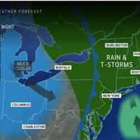
A summerlike stretch of warm, dry days will be followed by the arrival of a storm system bringing showers and periods of rain, leading to a change in the weather pattern.Wednesday, Oct. 4 will be clear with the hottest temperatures of the week as highs will reach the low 80s.It will remain dry on Thursday, Oct. 5, and temperatures won't be quite as warm, with the high in the ...
-

by
Joe Lombardi
Weather
Parts of the Northeast, mainly in and around New York City, saw their highest single-day rainfall totals in decades from a potent coastal storm system that will finally make its way out of the region on Saturday afternoon, Sept. 30.In the hardest-hit areas, water levels are decreasing but may take until early Saturday afternoon to drop below flood stage, the National Weather Service ...
-

by
Joe Lombardi
Weather
A pair of potential new tropical systems with the potential for development are being monitored by forecasters.The first, off the coast of Florida, is far west of Tropical Storm Philippe, which is now near the eastern Caribbean. (See the first image above.)"Even if a named storm does not form, tropical moisture from the region could continue to fuel downpours and thunderstorms in part ...
-

by
Joe Lombardi
Weather
It won't be long now. Soon, the effects of Post-Tropical Storm Ophelia will be in the rearview mirror and we will see the return of an old friend -- the sun.There will be a bit more rain at times on Tuesday, Sep. 26, before we see the return of dry weather -- and yes, dry weather -- on Wednesday, Sept. 27, the National Weather Service says."One final day of lingering rain and drizzle ...
-

by
Joe Lombardi
Weather
Post-Tropical Storm Ophelia will continue to affect much of the region with rain, heavy at times, and dangerous coastal conditions on Monday, Sept. 25, National Weather Service."Through Monday, Ophelia will slow track back offshore off the mid-Atlantic states, prolonging the duration of wet weather and gusty winds," according to AccuWeather.com. "Although Ophelia will continue to lose ...
-

by
Joe Lombardi
Weather
The first weekend of fall will be a washout as Ophelia, which made landfall in North Carolina as a tropical storm just over 24 hours ago, moves north-northeast.Additional rainfall amounts Sunday, Sept. 24 will be between an inch and two inches, bringing the total amount of precipitation for the weekend to around 2 to 4 inches with locally higher amounts. (See the first image above from ...
-

by
Joe Lombardi
Weather
Tropical Storm Ophelia is heading inland and northward, bringing heavy rainfall, coastal flooding, and strong winds that extend well beyond its center.Ophelia made landfall near Emerald Isle, North Carolina, on Saturday morning, Sept. 23. It's packed with 65-mile-per-hour winds and is moving at around 13 mph.Isolated tornadoes are possible from the system."Ophelia will spread drenching ...
-

by
Joe Lombardi
Weather
A newly named tropical storm that has formed off the coast of North Carolina will bring heavy rain that could cause flooding along with strong wind gusts to much of the Northeast this weekend.New update - Tropical Storm Ophelia Makes Landfall, Moves North, Will Bring Heavy Rain, Strong Winds To RegionTropical Storm Ophelia is packed with winds of about 60 miles per hour and was about ...
-

by
Joe Lombardi
Weather
A potent storm system currently identified as Potential Tropical Cyclone 16 is headed to the Northeast packed with heavy rain and strong wind gusts.Click here for a new, updated story - Tropical Storm Ophelia Forms Off Atlantic Coast: Will Bring Heavy Rain, Gusty Winds To RegionThe system, which will move into this region overnight Friday, Sept. 22 into Saturday, Sept. 23, and continue ...
-
by
Joe Lombardi
Weather
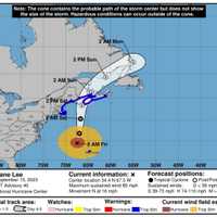
Hurricane Lee is now just hours away from unleashing damaging winds likely to cause scores of power outages along with drenching downpours in New England while coastal flooding and dangerous rip currents are expected in coastal New York and Connecticut.Updated story - New Tropical System Expected To Become Hurricane The timing for Lee's effects is from Friday night, Sept. 15 into ...
-

by
Joe Lombardi
Weather
A new week-long projected track for Monster Hurricane Lee has been released as forecasters are now saying its risk to the East Coast has increased."Hurricane Lee will remain a powerful storm after undergoing rapid intensification," according to a report by AccuWeather.com on Saturday, Sept. 8. "As Lee turns northward next week dangerous surf will develop along the East Coast while the ...
-
by
Joe Lombardi
Weather
A new week-long projected track for Monster Hurricane Lee has been released as forecasters are now saying its risk to the East Coast has increased.Click here for a new, updated story: Hurricane Lee Restrengthens: New Models Predict Timing, Expected Site Of Landfall"Hurricane Lee will remain a powerful storm after undergoing rapid intensification," according to a report by ...
-

by
Joe Lombardi
Weather
Hurricane Lee has rapidly strengthened to Category 5 status with new long-range, computer models predicting its eventual path could take it at or near the Northeast.Lee, now packed with maximum sustained winds of 160 miles per hour, is located over the warm waters of the Central Atlantic. It's expected to move over the Virgin Islands and Puerto Rico this weekend, according to the ...


